
Food Insecurity by ZIP Code
New York Finger Lakes Region and Western New York
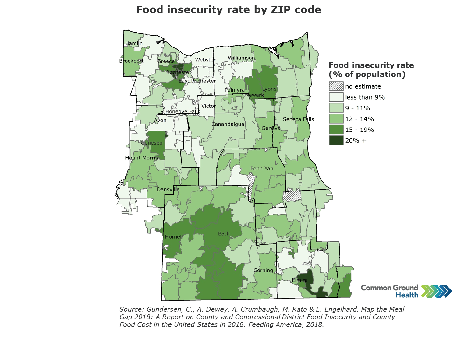
Access to nutritionally adequate foods is fundamental to maintaining health. The data that follows are based on the USDA’s measure of food insecurity which reflects a lack of consistent access to enough food for an active, healthy life. The ZIP and census tract level estimates were created by the Feeding America network’s Map the Meal Gap project.
The ZIP code-level map below shows a wide range of food insecurity rates across the Finger Lakes region. The highest rates of insecurity (20 percent or higher) are found in the ZIPs in the cities of Rochester and Elmira. There are also some rural and suburban areas with high rates in the 15-19 percent range.
Images are available for download at no cost and free of any copyright restrictions. We ask that you keep the Common Ground logo on the images to identify the source. To help us improve, we’d love to hear how you are using these resources. Email us at communications@commongroundhealth.org.


